Forgive the brief hiatus from the AT narrative, I was out in Minnesota for 10 days or so. I had to drive all the way out there (about 26 hrs of driving, further than Tennessee!), work a week, and drive all the way back. While the little bit of Minnesota and Wisconsin I saw were quite pretty, Illinois, Indiana, and Ohio didn't do it for me. I'm sure there's plenty of interesting critters and plants to be found in all those cornfields, but I don't think I could be bothered to look very hard. Like all states, I'm sure they have some pretty spots, but what you see from I-90 isn't much to write home about. I guess it's better to keep the traffic away from the pretty spots, the better to keep them from getting spoiled by throngs of people. Then again, it seems like most of the people on that route are on their way somewhere else, judging by the number of RV's and long haul truckers. I guess I fall into the latter category. On the bright side, there were some pretty flowers to be seen along the road while flying by at 70+ mph. The chicory is in full bloom right now (including here in Vermont). I'm tempted to try digging some up and making coffee out of the roots, but the flowers are too pretty to spoil and I don't like coffee anyway.
After getting back from Minnesota, I took a nice long walk around the back yard to see what was new. Turns out all sorts of things can change in a week! I don't know if it's all so interesting to me because I never paid that much attention before, or if every year is going to be this interesting to me. I guess we'll see. One thing is for sure, I will always welcome the coming of green stuff after a long winter. Speaking of that, it's looking like we'll be around here for another one.
I'll get back to the AT retrospective in a little bit. In the mean time, here are a bunch of pictures:
Back in Vermont, pre-Minnesota trip:
Luna Moth
Cluse-up of antenna.
Iris of some sort...
Haven't figured this one out yet.
Birdsfoot Trefoil (Lotus corniculatus).
And now, some from the midwest.
Sunflower? Laporte, Indiana.
No idea what this is. LaPorte, Indiana.
Marsh Pea? LaPorte, Indiana.
No idea about this one either. LaPorte, Indiana.
Common Nightshade (Solanum nigrum). Minnetonka, Minnesota.
One afternoon after work, there was a big thunderstorm that rolled through. I went wandering around after it had passed, hoping to find some katydids or cicadas blown from the treetops. Instead, I found hundreds of baby toads.
Oddly enough, their natural colors blended in perfectly with the cement curbs.
That was about all I had time for while out in Minnesota. So, here's some from the yard back home in Vermont.
Rosy Maple Moth.
Black-eyed Susan. I wonder if there's a story behind that name. Hopefully Susan wasn't a victim of domestic abuse. That reminds me of a bad joke...
The milkweed is blooming.
Damselflies sure are pretty. If my camera had a manual focus, I'd have lots more of these sorts of pictures...
Bur-reeds.
Blue Toadflax?
Hop-Clover (Trifolium agrarium).
Soft Rush (Juncus effusus).
Blue Vervain (Verbena hastata).
Young Green Frog that still has its tail.
Green frog tadpole that is getting its legs...
I can't figure out what this is. It looks like foxglove to me, but I don't think I've ever seen it this color, and it's usually taller from what I remember. This is right at the edge of a maple forest. It's not in my Vermont Wildflower guide, or in my North American one...
They call this "flowering raspberry" in the east, but I'm almost certain this is what is known as "thimble berry" out west. (Rubus odoratus). Looking up the scientific name, I answered that question. Thimble berry is indeed very similar, but it's a separate species (and only grows in the west, R. parviflorus).
Mossy tree trunk.
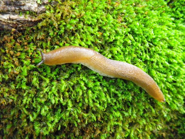
Slug. Hmm, how does one identify slugs?
Broad-leaved Dock.
Haven't bothered to look this up yet.
I think this is Self-Heal (Prunella vulgaris).
Not sure. Could be a younger plant of the thing above...
The insects are starting to sing again! This is a Roesel's Katydid.
A green frog (Rana clamitans) stares into the sunset.
Woke up around 6:00, took another shower. Ate applesauce and peanut brittle for breakfast. Healthy! Went to P.O. at 8:00 and shipped package and 3 postcards. Keith (Shaw) gave me a ride to the trailhead. I was hiking by 8:45. After about an hour, my right foot started hurting. Right in the arch area. When I cleaned my boots yesterday I noticed they have NO padding and NO arch support left. That’s probably what did it. I need to get some better insoles…
Hiking was mostly flat all day along a stream. Weather was beautiful! Too bad my foot hurt. Every day when something hurts or is going bad, I feel like quitting. But, I can’t. It feels so good to get to a shelter at the end of a day…
I had about 3 or 4 stream crossings today. I just left my sandals on for the last 6 miles or so. It made my foot feel a little better too. But, they have no ankle support so now that hurts! What a mess…
I tried to repair the crotch of my pants with duct tape. It held up, but the other side ripped out instead. Stupid pants.
Passed a northbound section-hiker named “The Wandering Astronomer” (I wonder what he does for a living…). I haven’t gotten into the whole trail name thing yet… maybe later…
Arrived at lean-to, finally, around 4:45. Felt great to stop. It is right on the shore of Bald Mountain Pond (it seems more lake-sized to me). There were lots of loons swimming around and making noise. Very peaceful.
Alone tonight… again. When will I meet up with someone to hike with?
Ate Ramen and had 3 cups of yummy cappuccino. A nice treat! So was the snickers bar at lunch! Thanks mom!
No bugs today until I got to the shelter, but they didn’t bother me much. I’m going over MoxieBaldMountain tomorrow (it’s supposed to be one of the prettiest on the AT). Hope I’m not distracted by foot/ankle/knee/leg/shoulder/neck pain!
Going to bed now…
Day 11
Tuesday, 6/20/00
Moxie Bald Lean-to to Pleasant Pond Lean-to
13.1 miles
Woke up to a bunch of noisy loons around 5:30. Got out of bed soon thereafter. Ate oatmeal (AGAIN!) and left by 7:15. Nice weather! Great view from MoxieBaldMountain. Could almost see Katahdin! At bottom of hill, I passed “Freight Train”. This guy carries a beaver-cut stick that’s about 8 feet tall and 3” in diameter. Despite the name, he doesn’t move fast.
Had a pretty long ascent up PleasantPondMountain. At the top I met Don Parker, who was working on the trail. We hiked down together and I talked him into giving me a ride to the store in Caratunk (6 miles off trail) and back. Nice guy! When I got to the shelter, Ryan was here. She is a girl I met on my second day at Potaywadjo Lean-to that was doing the 100-mile wilderness northbound. Back then she said she’d drop off some goodies at this shelter. She did!!! (If I remember correctly, she was working the summer at one of the raft companies that run the Dead and KennebecRivers out of the Caratunk and The Forks area). She brought a cooler with 4 ice-cold beers and two whoopie pies!! What a gift! (I wasn’t much of a beer drinker in those days, so I didn’t have any of those, but I did have a woopie pie, which was a new experience for me. To you non New-Englanders, a woopie pie is basically a sandwich made from two pieces of chocolate cake filled with gooey cream). Talked a while then she had to go. After an hour or so, “Freight Train” pulled in. I gave him the beers and other woopie pie.
Ate dinner, drank OJ (that I bought at the store in town) and wrote.
My foot didn’t hurt too bad but now my left shin hurts! Tomorrow, either both legs will hurt or neither! I hope it’s the latter.
So overall, a good day! My first dose of “trail magic”! Have to be at the KennebecRiver at 10:00 tomorrow to catch the canoe ferry. 6 days to Rangeley! (The Kennebec is one of the larger rivers in Maine. This far north it is a hundred yards or so wide. If you cross in the right place, it can be shallow enough to ford. However, there is a dam upstream, so the levels can rise quickly and unexpectedly. Several hikers have been killed over the years attempting to ford it. I met a hiker later on who had nearly drowned attempting it that year. Instead of building a bridge or rerouting the trail along a road bridge in Caratunk, some friendly MATC volunteers operate a canoe ferry during a few hours each day. The times are posted in the shelters leading up to the crossing).
Day 12
Wednesday 6/21/00
Pleasant Pond Lean-to to West Carry Ponds Lean-to
19.7 miles
Woke up about 5:30 this morning. All I ate was a little thing of applesauce – saving fuel. Left lean-to about 6:30. I was truckin! Only took me 2 hours to make it 6 miles to Caratunk. I walked into town and called home, then went to the river at about 9:00. (This 3 mile an hour pace is pretty good for a beginner in Maine. Later my pace would increase to better than 4 or 5 miles per hour if the terrain was easy. It got to a point where I was disappointed to only hike 3 miles per hour.) Lounged around for about an hour waiting for the ferryman. I thought about fording it…
Made good time all day. The terrain was pretty flat. It was probably the most boring 20 miles I’ve done! FINALLY nothing hurt. It was great! Except the last 5 miles or so my back started to hurt right between my shoulder-blades (I guess I meant my legs or feet didn’t hurt). Feels like someone stabbed me there and left the knife in! But that pain seems to happen after every long day…
Went through the ArnoldSwamp and on the Arnold Trail. Benedict Arnold was assigned to attack Quebec during the Revolutionary War, but he never made it partly because he got stuck in this swamp! It was really buggy! Stupid black flies! (I also remember that the “bog-logs” were submerged through a lot of this, and I was trying to balance on submerged logs that I couldn’t see beneath the black water.) Passed a boyscout troop near the end of the day. The ended up staying at the same shelter. AARGH! Lots of kids running around, but at least they aren’t too loud.
I got here at about 4:15, quite a long day. Starting on the BigelowRange tomorrow. They’re wicked steep! Hope my legs hold up OK. (From Moxie Bald, the BigelowRange looks very intimidating. I remember being surprised to see such jagged mountains in New England. They look much worse than Katahdin.) I only have to go about 12 miles, but it’ll be RUGGED. Five more days till Rangeley!
Rained some of the night… Hopefully not tomorrow! We’ll see…
Today was the summer solstice. I guess it’s a tradition to hike naked on this day. I forgot… I didn’t meet any other naked people either… (Not would have the bugs made naked hiking miserable, but running into a troop of boyscouts might be a little awkward too…)
Day 13
Thursday 6/22/00
West Carry Pond Lean-to to Safford Notch Campground
12.2 miles
Woke up pretty early and ate oatmeal (I’m sick of it already!). Packed fast and was on trail by 6:45. After about 5 miles, I met my first north-bound thru-hiker, “Mr. D”. He started in February!
Decent hiking until reaching Bigelow Preserve. Gorgeous! After a 3 mile climb up Little Bigelow, there was a spectacular view. I could see for miles! (See photo below this entry) It wasn’t cold either. Sugarloaf (2nd hightest mountain in Maine after Katahdin and huge ski resort) was just across the valley (The CarabassetValley) and BigelowMountain loomed ahead. I felt great! No leg pain or back pain, the weather was nice, the trail wasn’t steep (too steep) and there was a good view. I don’t know where this optimism is coming from! Must be in the water… (This is probably one of the prettiest mountain ranges on the AT in my opinion)
Got to campsite at 1:45! Kind of early but I made out that schedule to Rangeley so I might as well stick to it. I don’t want to sit at the trailhead there for two days… I probably could have made it up and over Bigelow to the next lean-to, which is five miles. Oh well, guess I’m faster than I thought.
At that Near East Rice Pilaf mom sent me for dinner. Boy was it GOOD. Took a while to cook though…
My right pinky toe-nail is ready to fall off. Yucky! It’s just hanging on by a corner. It doesn’t hurt at least.
Only saw that one guy today. I’m getting sorta lonesome. Alone again tonight! Maybe I’ll catch someone tomorrow. I doubt it. But I hope so! Looking forward to seeing the family and whoever they drag along with them… Hope they bring some cookies or something too! Can’t wait to see my new trumpet either! Only 4 days…
It started pouring around 7:00pm. In a hurry to zip my rain-fly, it got jammed. I couldn’t get it loose, so I had to cut it. Still didn’t work! I was able to clamp it shut with my mini-pliers though. After the rain died down, the rain was dripping off the trees right onto my tent. This must be how the Chinese came up with water torture…
A view of the Bigelow Range from Little Bigelow.
Day 14
Friday 6/23/00
Safford Notch Campsite to Cranberry Stream Campsite
8.5 miles
I’m writing this part about 5:00 am. I got up, got my food out of the tree and decided I might as well go back to sleep. I only have 8.5 miles to go today. I couldn’t get my mind off all the people I wish I could see right now (I can’t remember who would have been on my mind). I don’t know why I’m getting so lonely, it’s not like I was much of a social person in school anyway… must be the isolation… not even having the option of talking to someone. I guess I’ll have to get over it…
Left around 7:30. Kind of dreary hiking… Everything was still all wet. Long, steep climb up AveryPeak. Ran into clouds about halfway up. So much for the view! When I got to the top (4,088 feet) the wind was howling! I bet it was gusting about 75 mph! Almost blew me over a couple times. I stayed on the summit for about half an hour, waiting for it to clear. It never did, but every now and then a clear spot would show up and you could see blue sky for a short time! What a weird sensation The coulds were, well… I was in the clouds… But it seemed like the mountain was moving, not the clouds! It was cool! And literally cold too.
When I got up from hanging around, the inside of my left quad hurt like hell! It was really stiff and hurt bad when I’d support my weight on it. Bad day for this to happen! Guess this time the mountain was tougher than me. Har har.
Kept going though. Met John, the volunteer caretaker at Horns Pond Lean-tos. Nice setup he had, cool guy too. He hiked 2 of the 3 miles down to the campsite with me. 2 other people are here now! Woohoo, company! One of them knows Adrianne M. (girl from highschool in Boothbay) They’re from Boston. Small world…
The Bigelows are gorgeous! Once I’d gotten to West peak, it had cleared up. What a view! I’d love to come back and day-hike it. I highly recommend it! (Unfortunately, I haven’t been back there since!).
The view I had from AveryPeak. I had started at the low spot in the middle of the map and went up and over the Bigelows to the low spot on the left of the map. Also making an appearance are the boots I was wearing (and gaiters, which I got rid of eventually).
Day 15
Saturday 6/24/00
Cranberry Stream Lean-to to SpauldingMountain Lean-to
15.4 miles
Don’t remember when I woke up… choked down MORE oatmeal! Even the “good” flavors (Strawberries & Cream was my favorite) suck. I get nauseous just thinking about it. No problem with Ramen yet though… Anyway, on the trail around 7:20.
Long, long climb up CrockerMtn. Higher than Bigelow, but no view. Met Chris & Jared, two southbounders. Hiked with them most of the day. My leg felt good all morning until about 10:00. It has hurt ever since. Here’s when it hurts: (I drew a cartoon showing it hurting pretty much all the time).
It helps a little to use sticks for support, but all the ones I found kept breaking!
Got to Crocker Cirque Campsite about 1:30. Rested for an hour and decided to keep going. BAD move! I had to go another six miles up! And, my leg was killing me. There was one spot on the backside of Sugarloaf where I climbed 1,000 vertical feet in about a quarter mile! That’s steep!
Got to lean-to, FINALLY, at 6:00. What a relief! It felt so good to stop! Since I went extra mileage today, I only have to go 8 tomorrow!
Hope my leg will be up to the task. It better be. I’m thinking of taking some extra time off in Rangeley, maybe even go home for a while. My leg needs to heal…
We’ll see.
Day 16
Sunday 6/25/00
SpauldingMountain Lean-to to Poplar Ridge Lean-to
8 miles
My shortest day so far! Got to lean-to before 1:00…
Woke up late, didn’t eat breakfast. Left around 8:30. Had decided today was gonna be easy. The terrain wasn’t steep either. It was flat for a mile, down for three, that a mile, up for 3.5 miles, then down a half mile to the shelter.
Leg felt ok most of the day, but the pain was there. I used sticks all day and that seemed to help…
Well, the day was so short, I don’t have much to write about. It looks like rain right now (~5:00). I hope it gets over with tonight because I have 3 miles of high, steep slickrock to do tomorrow! There’s even a warning about not doing that section in the rain. Yikes!
I’m so eager to get to Rangeley. Only 10.7 miles! Get to see the parents, Ford, my new horn, and what/whoever else they bring along. Get to check my email. Somebody better have written me! Eat real food! All sorts of good stuff. OOOh, and taek a shower and do laundry! I can’t wait!
Well, got about 3 peaks tomorrow, so I’d better get some rest.
Rained for a long time. Real hard too…
Day 17
Monday 6/26/00
Poplar Ridge Lean-to to Maine Rt. 4 (Rangeley)
10.7 miles
Woke up about 6:00. It had finally stopped raining. Had to eat something, so I choked down some oatmeal. BARRRF! Left shelter about 7:15.
Made good time up Saddleback Junior and The Horn. Both were treeless on top. Good views! No trees from The Horn over to Saddleback. Interesting and pretty.
When I was about 100 yds from the summit of Saddleback, I saw a moose grazing on the trail. I tried yelling at it to scare it off, but it just kept on eating. Meanwhile, I was being eaten alive by blackflies! It kept going back and forth across the trail for half an hour or so. Then, it decided it would sit down right on the trail! By this time I was thinking I’d wasted enough time, so I try to sneak by. As soon as I got within 10 feet of it, it jumped up, snorted and started heading my way! So I took off back to where I’d been and it sat down again. I went back to a little ridge to see if I could see other hikers coming. When I got there, wasps started swarming around me! So, I ran from them, back towards the moose. Eventually, two other hikers showed up and I took a bunch of pictures. Then, all three of us made a bunch of noise and waved our arms as we walked towards the moose. It finally got up and walked away! I wasted over an hour for that stupid moose.
Anyway… it was hazy so I couldn’t see Mt.Washington from the top. Met four north-bounders on the way down.
I got to the trailhead around 1:00. I had to wait 4 hours for Mom & Dad but it was worth it. Good to see them and my new trumpet! It’s awesome. Got my maps, poles (some old fiberglass XC ski poles from a garage sale), pants and stuff too. Phoebe (Friend from school, and good friend to this day) sent me some stuff too. Thank you so much!
Felt GREAT to take a shower and put on clean clothes!
I’m utterly exhausted, so this might be brief… Woke up around 4:00am to “The Bull” saying a prayer for me… Got up about 6:45, but didn’t leave until around 9:00
6-mile downhill warm-up before hitting some killer mountains. Knees felt fine all day though. There were some climbing sections! (By that I mean you had to use your hands, similar to the Hunt Spur on Katahdin). Doesn’t the MATC [Maine Appalachian Trail Club] know about switchbacks!!? So steep I wanted to cry! Didn’t get any view from the summits either because of clouds. AARGH! Staggered into lean-to (which is located ½ mile off the trail!) around 6:00. Ate, wrote, slept…
By far my hardest day so far. Slept alone. Kind of lonely… A day and a half until Monson! Can’t wait.
Oh… while fording the W. Branch of the Pleasant River, I fell in! Felt refreshing. Wasted half an hour though. Good night!
One particular thing I remember about this night was hot-dog flavored water. Though there was a beautiful pond nearby, I was too tired to go down to it and filter water. Fortunately, there was a bucket full of rainwater by the lean-to, so I filtered from that. My pasta tasted fine with it, but my dessert (Carnation Instant Breakfast, another thing that didn’t work out well for me) tasted quite salty and meaty. I guess someone must have boiled hotdogs and dumped the water in this bucket. That’s what I get for being lazy!
A view of the "trail" in the Barren-Chairback Range.
Day 7
Friday, 6/16/00
Cloud Pond Lean-to to Little Wilson Falls
12.5 miles
Woke around 6:30, ate oatmeal (!), gone by 8:30. Climbed a mile to summit of Barren Mountain. There was an abandoned firetower, but it was all cloudy, so I didn’t bother climbing it to see the view. Steep 3-mile descent to a pretty river. Next section of trail was horrible! Extremely overgrown with blowdowns every 100yds!
Passed Wilson Valley Lean-to then came to a railroad track! Ah… wilderness (Just a reminder here, the first 100 or so miles [last 100 if you’re a northbounder] are known as the “100-mile Wilderness” because of the remoteness and lack of resupply opportunities). Had to ford Big Wilson Stream. Chilled out there for about 45 minutes (I remember sunning myself on a big smooth boulder with my feet soaking in the icy water while Tiger swallowtail butterflies flew around). I was so thirsty, I put the hose of my filter in my mouth and just pumped away! Refreshing! Kept my Teva’s on for the rest of the day to let my feet air out…
Got to Little Wilson Falls around 3:00. Very Pretty. Decided I’d tent it since I carried that stupid thing 100 miles and I’m only 4 miles from a shelter and maybe 7 from Monson. (The tent I started off with was a Eureka “Solitaire” which was quite light and compact, but also extremely cramped and uncomfortable. It was fine this night, but later on I’d have trouble with it in a couple rain storms and eventually sent it home.) Oh well, I just hope I don’t get trampled by a moose at night…
My right pinky toe has been one big blister since day one, but it hadn’t hurt until today, after I stopped. Now it’s all red. The toe-nail is just kind of floating in a big blister. Yuck! I’ll probably lose it (the nail, not the toe!). Everything else seems to be ok, except for all the bug bites, and my shredded shorts. (I started off the hike wearing some mid weight hiking boots that I had worn for a year or two. Though they were pretty comfortable, they fell apart pretty quicky, as you’ll see. This blister on my pinky toe was the ONLY blister I had the entire trip.)
Hopefully I’ll make it the ~10 miles to Monson before noon so I can pick up my first maildrop before the P.O closes. Sure hope it’s there Mom! After my super-fast beginning, I decided to slow down and enjoy it (that, and I finally hit some mountains!). (Before the trip, I packed several packages of food for myself and arranged for my mom to send them to post offices near the trail. This was common practice when I did it, but from what I hear isn’t done much anymore. Also, I never really did slow my pace down very much.)
I will write a conclusion to the 100-mile wilderness in Monson. I plan to stay at “The Pie Lady” (hostel), or maybe Shaw’s Boarding House. We’ll see…
Day 8
Saturday 6/17/00
Little Wilson Falls to Shaw’s Boarding House (Monson, ME)
6.6 miles (+3.5 miles into Monson)
Awoke this morning before 6:00! Didn’t eat breakfast and was on trail around 6:00. Mostly flat, made good time. Incredibly humid though! Felt like I was back in Mississippi! Made it to Rt. 15 [The road into Monson] around 9:00.
Walked in scorching heat for 3 miles (with no water left) before some rednecks picked me up and drove me the last half mile.
Shaw’s is a “hiker hostel”. Supposedly a legendary one… over 28,000 hikers have stayed here! Plus, they have AYCE (All-you-can-eat) meals for cheap. (Shaw’s also caters to snow-mobilers in the winter time. Keith Shaw, the proprietor was still alive when I went through, but he died a year or two later. However, the place is now run by his son. http://www.shawslodging.com).
As soon as I got to Monson, I went to P.O. (15 minutes before it closed!) and got my maildrop. It will suck to add more weight to my pack… I’m sending some thing back though: maps, guide-books (minus the Maine section), extra pot (no, not marijuana!), container that had Bailey’s, cup, etc…
After going to the P.O., I took a shower. FINALLY. It felt so gooood!!! But, I had to put dirty clothes back on. Then, I went to the Laundromat and did laundry, except for what I was wearing of course. Had a really good sandwich too, with veggies and FRESH stuff. Quite tasty.
Then, I came back, drank a half gallon of O.J. and read/wrote. Thanks for the book, y’all. That’s about it for right now…
Ate dinner here at Shaw’s. Had chicken, mashed potatoes, veggies, etc… Keith Shaw is relentless about eating as much as you want. Didn’t eat much though. Went to bed around 10:00. (I think Keith mistook me for a north-bound thru hiker. By the end of the hike, or after a month or so in my case, your appetite becomes huge and you can eat an amazing quantity of food).
Day 9
Sunday 6/18/00
Shaw’s Boarding House, Monson, ME
0 miles
Woke up about 7:30 for breakfast. It was huge and very good. French toast, bacon, hash-browns, eggs and O.J. As much as I could eat! Very good deal for only $4.50.
Lounged around all morning, cleaned stuff (pans, water filter, etc.), packed, and got stuff together to send home. I am sending back some food because I don’t want to carry any more than I have to! (Again, a clear sign I hadn’t been on the trail long. Later on, I would eat everything in my maildrop while at the post office, then head into town to buy groceries for a week or so. Without fail, I’d eat all that in 3 days and have to go back into town sooner than I’d planned. But we’ll get to that…)
Finally got to check my email today. I was a little disappointed at how few I got! Come on people! I wrote emails to a couple people too…
There’s nothing to do here! The population is 500 and none of them seem to be in town! Oh well…
Staying in town is expensive! I need to budget my money. I’m eating some of my extra food for dinner tonight to save money. Same with breakfast tomorrow. The P.O. opens at eight, so I’ll send my postcards and box and then hit the road, I mean trail… (Hey, does anyone still have any of the postcards I sent?)
I’ll be hitting some BIG, STEEP mountains the next couple weeks. Oh no! Hopefully it’ll get my fat ass into shape! 8 days and I have to be in Rangeley (To meet up with my folks). Shouldn’t be too hard. Can’t wait to see the family and my new sleek, black trumpet! Yeehah! (I was/still am a trumpet player. Back then, I was really into it, and my highschool graduation present was a black-lacquered trumpet. She’s still just as pretty as she was then).
I’m glad the 100-mile wilderness is behind me. Hopefully I’ll catch up to some more people soon. I guess there are a bunch about 4 days ahead. I probably won’t catch them before Rangeley, but I have about 5 months to catch up! No hurry I guess…
I hope whoever reads these entries and the ones to follow enjoy them. I hope there is nothing offensive in them either. I will try to keep everyone informed of my progress (or lack thereof). Enjoy!
It occured to me a couple days ago that this time of year ten years ago some pretty big thing happened, and were about to happen. First of all, I'd just graduated highschool. But, most people do that, so it's nothing special. What was really on my mind was the start of my thru-hike of the Appalachian Trail. On June 10th, 2000 Teal (my older brother), a friend from school Rachel, and I hiked up and back down Mt. Katahdin in Maine, the starting point of a southbound (Maine to Georgia) thru-hike. The years since then have been full of all sorts of good, bad, exciting, scary, fun, and sad things as life is wont to be full of. Teal now has a kid on the way, Rachel went from being a person I barely knew from school to one of my best friends, and I wound up walking all the way to Georgia.
Throughout the four plus months I was on the trail, I kept a daily journal. Initially, I was pretty anxious about what I was getting into and my entries contained thoughts about what lay ahead, and what was behind (highschool), but eventually as I got into the rhythm of eat-hike-eat-sleep-repeat the entries became more focused on mileage and food.
Much has changed in the long-distance hiking world since I did this hike. Lightweight gear was only just beginning to show up, hiking in sneakers was still a pretty wild idea, there were no internet websites to help you out and discuss thru-hiking, there were no online journals to chronicle the trip, and there were no worthwhile (compact, good battery life, good resolution...) digital cameras available. I kept my journals the old fashioned way, scribbled in a notebook. My pictures were mostly on slide film (and pretty much useless now), so there isn't much of a visual record of the trip besides the images in my head.
I didn't set out on this trip for soul-searching, and it was kind of on a whim (I'd decided to do it after hearing about it from my English teacher, Mr. House.). I didn't know what I wanted to do for college, so I decided I'd take a hike and maybe I'd figure it out...
Here are my entries from the first week or so. If you have any interest in reading the rest of them, please let me know. I've long wanted to get these things typed out, so it'd be good motivation to if I knew people were interested in reading them. Any comments will be made in italics. I'll start with a picture of me on the summit of Katahdin:
The beginning.
Day 1
Saturday, 6/10/00
Katahdin Stream Campground to Katahdin (BaxterPeak) and Back
10.4 miles
Woke up to Rachel’s snoring around 7:00. Got up around 7:30, cooked some oatmeal. It was alright, I’m sure I’ll eat a lot more of it! (I eventually ate so much of it it made me nauseous to look at. I won't eat instant oatmeal to this day) Got our campsite squared away at 8:00. Cleaned up camp and packed.
Started hiking at 8:30. Teal took the lead most of the way up. There were some fairly technical rock sections about 2/3 up. Got excited over a false summit with to miles to top. AARGH! Above treeline it was very windy & cold, below freezing. We had a decent view. Reached top at about 12:00.
Made good time coming down. Passed several people. Kills the knees though. Katahdin stream falls is really pretty. Made it back to camp at about 3:00pm. Rachel set up the tent, Teal and I sat around – that’s the way it oughtta be! Ha.
Cooked dinner about 4:00. Rachel went right to bed. Teal soon followed. I tried to lighten my load and cleaned up camp. Black flies aren’t as bad as I thought. Have seen a couple moose, both within 10 feet of us.
Rach and Teal are both z-ed out. I’m sipping Bailey’s and writing. One day without a shower and I don’t stink yet!
It’s starting to sink in what I am about to do and that I’m done with highschool. It is going to be quite the journey! I hope I hang in there. I already miss the few friends of mine. Rachel and Teal are good company though, too bad I only have a short time with them. I hope I meet some cool person to hike with… we’ll see.
Going to bed ~7:00pm.
Day 2
Sunday, 6/11/00
Katahdin Stream Campground to Rainbow Stream Lean-to.
24.9 miles
Woke up to rain around 3:00am, never really got back to sleep. Got up about 7:00, ate some breakfast. Rachel had snuggled up during the night to stay warm. She said I kept kicking her though… Got stuff out of the car and started packing in the rain. Left for the trailhead ~8:00. I asked Teal and Rachel not to hike with me the first day because it would be miserable for them. I felt sad not having them come along. They hiked with me for about 10-15 minutes then we had to part. Big hug from Rach, firm handshake from Teal, and I was off.
Rained the whole morning and the brush was wet after that. First 9 miles were along a river – very pretty. Would have been beautiful hike with Teal and Rach if was sunny. Made it 9.5 miles in 3 hrs! Made it to Hurd Brook lean-to by 12:30. Ate lunch and continued on. Got spooked by some woodpecker banging on trees. Didn’t know what it was!
Trail was extremely slippery and muddy. Like a f**king mud bog! Boots, gaiters, socks, pants, jacket, and t-shirt all got soaked. I was, with the exception of my feet, still pretty comfortable though.
Hiked along RainbowLake for a long time. Eventually slogged all the way to the lean-to [Rainbow Stream lean-to] and tumbled in. Arrived about 5:15. Cooked up some ramen while I changed out of wet stuff. Felt GOOD! About a half hour later two guys showed up. They had started at Hurd Brook lean-to and somehow I passed them without seeing them.
The sun came out for a while! Then it went away because it does that at night sometimes…
It was about 40 degrees [Fahrenheit] all day. Doesn’t feel like June!
Wrote in journal, sipped some more Bailey’s and went to sleep… finally!!! @ 8:00pm.
Hurd Brook Lean-to
Day 3
Monday, 6/12/00
Rainbow Stream Lean-to to Potaywadjo Spring Lean-to
18.2 miles
Woke up about 8:00, a little late. Packed and left by 9:30. Hiking along a creek was gorgeous, nice weather too. Several fisherman in the area.
There were quite a few calf-scorching ascents, especially up Nesuntabunt mountain. Beautiful view, pretty lake, Katahdin in the background. Gnarly descent back down. Hiked along lake for a while, came to a fishing camp hoping they had some cold ones, but no one was there. Came to some other creek then was in a low-land swamp for the rest of the day. Passed Wadleigh Stream Lean-to around 1:00pm. Drank lots of water – hot weather.
Last 3 miles to shelter were bug-infested. So was shelter. 3 people were there – a couple from Canada and some north-bounder from Tufts. Arrived at Potaywadjo shelter at 4:45. It is maintained by L.L.Bean. Very nice and big. Around 6:00 two other hikers showed up. Cool guys.
I’d wanted to go further but the next shelter was about 12 miles uphill. Screw that! Turned out to be a really nice place. May hit some mountains tomorrow.
I hope I find someone to hike with soon. I hike alone all day, kind of boring sometimes. We’ll see…
Day 4
Tuesday, 6/13/00
Potaywadjo Spring Lean-to to East Branch Lean-to
19.5 miles
Woke up at 6:30. Tara [one of the Canadians] was up before me though. Hardly ate anything for breakfast, just a little oatmeal. Took off by 8:00. Blistering pace due to mosquitoes that would descend like bats out of hell everything you stopped. Had about 3 layers of DEET on, seemed to help a little. I really regret leaving my head-net behind now.
Going was flat until Cooper Brook Falls Lean-to. Made it there (11+ miles) around noon. Gorgeous place. Shortly after leaving a grouse came out of nowhere and chased me about 20 yards back up the trail! Must have been rabid or something… Had to bushwhack about 50 yards to avoid it!
My pack is starting to chafe my hips. Ouch! Feet are doing OK though. Had one hellacious climb to the top of Little Boardman Mountain (1,980’) where I met “Turtle” and “Willow”, a couple from Tennessee. Turtle looks like the classic hill-billy, and he’s a cool guy. Willow was also nice. Shared some of my Bailey’s with them. They had a lot of dehydrated fruit that was really good.
Raced them 3 miles down to East Branch Lean-to. Beat them by an hour and a half! Hurt knee a bit coming down though. I need to slow down and enjoy it more!
Big mountains to climb tomorrow, that oughtta slow me down! Exactly 50 miles to Monson [Maine]!
Day 5
Wednesday, 6/14/00
East Branch Lean-to to Carl A. Newell Lean-to
10.8 miles
Woke up early, left camp by 8:00. Said goodbye to Willow and Turtle. Made it up to Logan Lean-to by 9:35. Brutal climb up to summit of WhiteCapMountain. Excellent view! Took some pics. Very windy and a little chilly (up at 3,640’). Took it slow going down so I hope I don’t blow out my knees again. They’re feeling better now. I only went about 11 miles to give them a break.
Got to lean-to around 2:00. Read some of the guide and planned ahead. About 4:30 “The Bull” showed up. He’s a 70-year-old section hiker from Michigan. Kind of a boring day.
I really, REALLY stink now! Can’t wait to get to Monson and do laundry and get real food. Few bugs today!
Hard day tomorrow! Willow and Turtle showed up later. Good to see them again! Probably won’t again though…